Washington, D.C., December 15, 2025
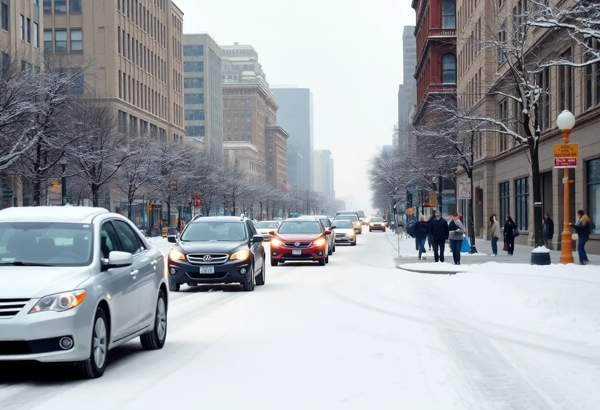
Following a significant snowstorm, Washington, D.C. is experiencing hazardous driving conditions due to rapidly dropping temperatures and the potential for black ice on roadways. Officials are urging motorists to exercise caution and prepare for slippery roads. Snowfall has ranged from 1 to 5 inches across different areas, prompting a Winter Weather Advisory from the National Weather Service. Residents are advised to stay informed about weather updates and to take necessary precautions while traveling.
Washington, D.C. Faces Hazardous Driving Conditions Following Recent Snowstorm
Washington, D.C. – Blustery conditions in the Washington, D.C. area are creating hazardous driving conditions following a recent snowstorm. As temperatures drop rapidly after the morning’s snowfall, officials are urging drivers to exercise caution due to the possibility of black ice forming on roadways. The National Weather Service has issued a Winter Weather Advisory, warning of slippery road conditions and advising motorists to plan accordingly.
Details of the Snowstorm
The snowstorm began late Saturday night, December 13, 2025, with snowfall accumulating between 1 and 3 inches across the D.C. area. Localized totals of 4 to 5 inches were reported in some regions, particularly in Baltimore and northeastern Maryland. The heaviest snowfall occurred between 1 a.m. and 7 a.m. on Sunday, December 14.
Current Weather Conditions
As of Monday, December 15, 2025, temperatures in the D.C. area have dropped significantly, leading to the formation of black ice on untreated road surfaces. The National Weather Service advises that black ice can form when recent rain or snowmelt comes into contact with freezing temperatures, often making it invisible to drivers.
Safety Recommendations
Motorists are advised to slow down and use caution while traveling, especially during the morning and evening commutes when black ice is most likely to form. Pedestrians and cyclists should also exercise caution on sidewalks and bike paths. Residents are encouraged to stay informed about local weather conditions and heed any advisories or warnings issued by local authorities.
Background Context
The recent snowstorm is part of a larger weather system that has affected the Mid-Atlantic region. The National Weather Service had issued a Winter Weather Advisory for the D.C. area ahead of the snowfall, predicting snow accumulations between 1 and 3 inches, with localized totals of 4 to 5 inches possible. The storm has also led to school closures and delays in the region.
Additional Information
For the latest updates on road conditions and weather advisories, residents should consult local news outlets and the National Weather Service. It’s important to stay informed and prepared during winter weather events to ensure personal safety and the safety of others.
Frequently Asked Questions (FAQ)
What is black ice?
Black ice is a thin layer of ice on roadways that is often invisible to drivers, making it particularly hazardous. It forms when recent rain or snowmelt comes into contact with freezing temperatures.
How much snow did the D.C. area receive from the recent snowstorm?
The snowstorm that began late Saturday night, December 13, 2025, resulted in snowfall accumulations between 1 and 3 inches across the D.C. area, with localized totals of 4 to 5 inches in some regions.
What precautions should drivers take during winter weather conditions?
Drivers should slow down, increase following distances, and remain alert for slippery road conditions, especially during the morning and evening commutes when black ice is most likely to form.
Where can I find the latest weather updates and road conditions?
Residents should consult local news outlets and the National Weather Service for the latest updates on weather conditions and road advisories.
Key Features of the Recent Snowstorm
| Feature | Details |
|---|---|
| Snowfall Accumulation | 1 to 3 inches, with localized totals of 4 to 5 inches in some areas. |
| Timing | Snow began late Saturday night, December 13, 2025, with heaviest snowfall between 1 a.m. and 7 a.m. on Sunday, December 14. |
| Current Conditions | Rapidly dropping temperatures leading to the formation of black ice on untreated road surfaces. |
| Safety Recommendations | Motorists advised to slow down, increase following distances, and remain alert for slippery road conditions. |
| Background | Part of a larger weather system affecting the Mid-Atlantic region, leading to school closures and delays. |
Deeper Dive: News & Info About This Topic
HERE Resources